Predicting Economic Development Using Geolocated wikipedia articles
- Estimate socioeconomic indicators using open-source, geolocated textual information from wikipedia articles
- NLP techniques are used to predict community level asset wealth and education outcomes using nearby geolocated Wikipedia articles
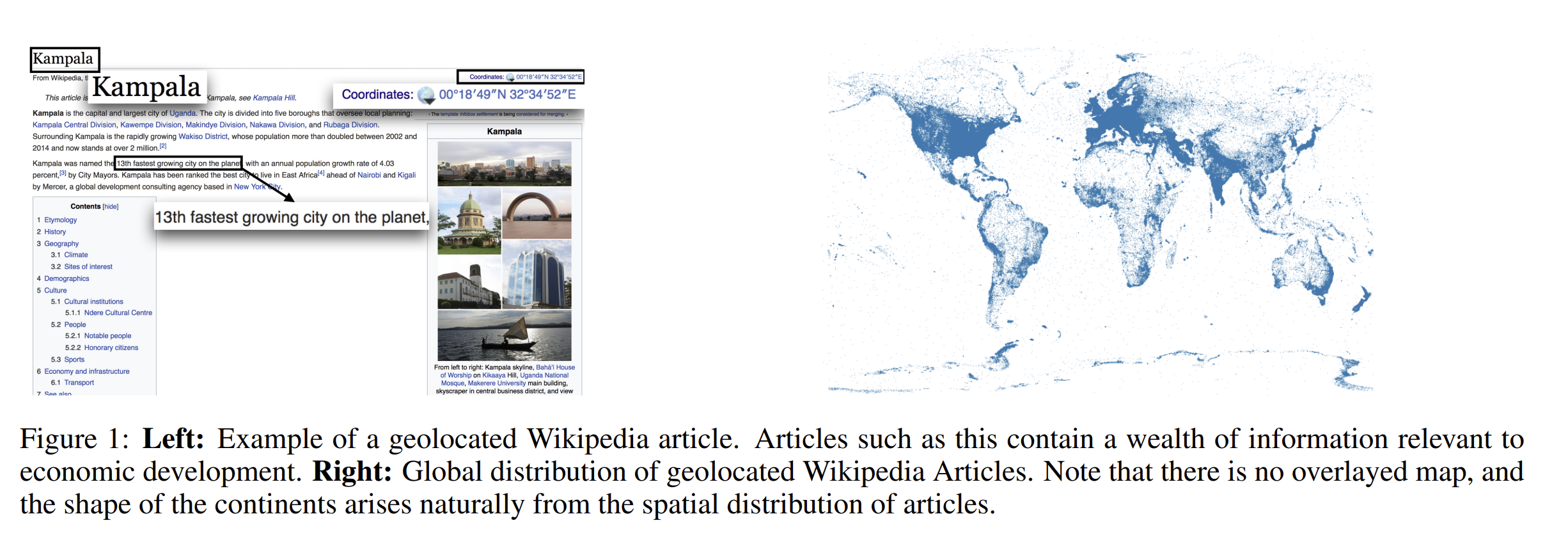
- Many wikipedia articles are geolocated. Many developing regions of the world contain high concentrations of geolocated articles. These articles contain a rich textual information about locations and entities in an area
Approach
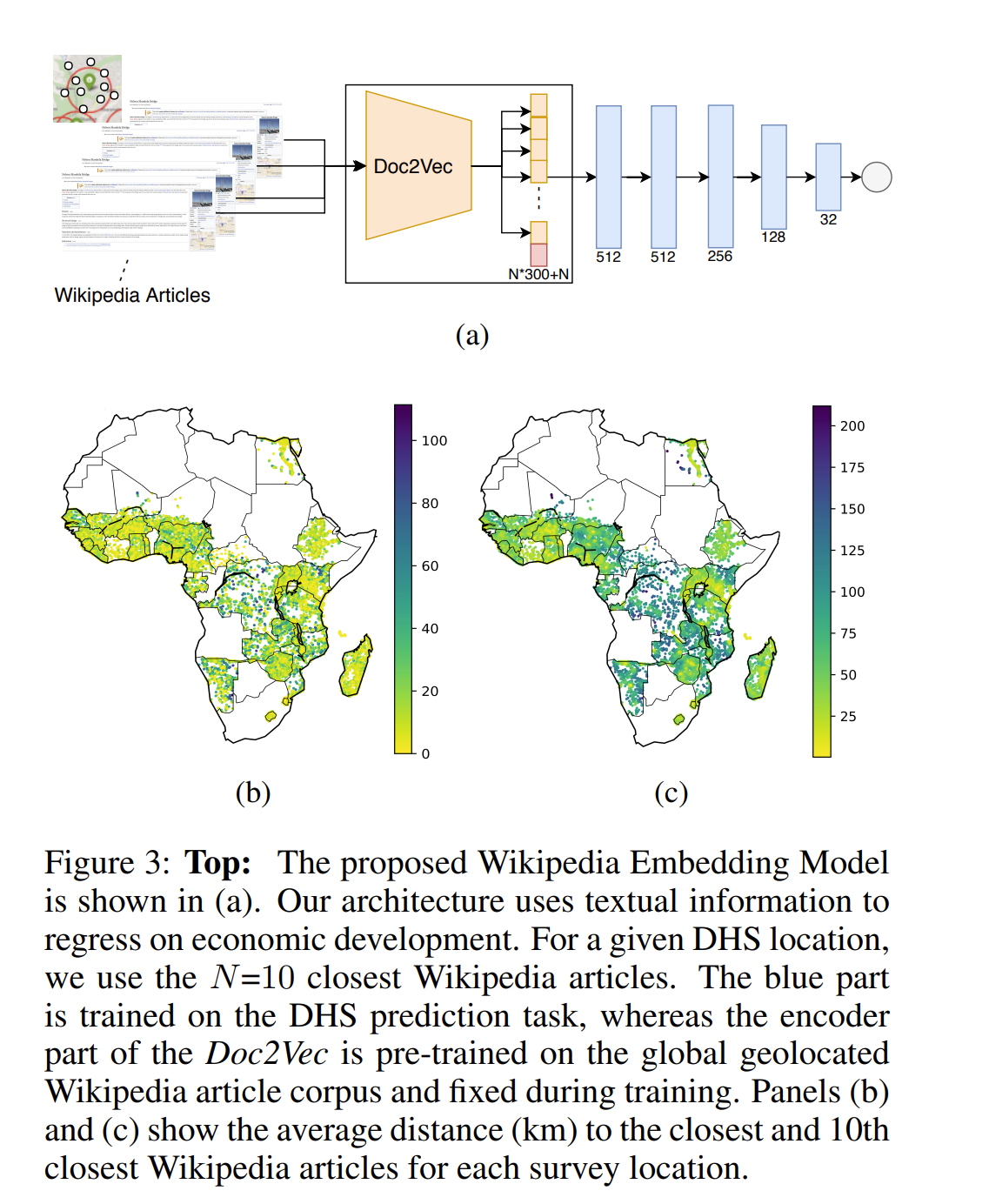
- Geolocated articles are mapped to a vector representation using Doc2vec method
- Use spatial distribution of the embeddings to predict socioeconomic indicators of poverty, as measured by ground-truth survey data collected by the world bank.
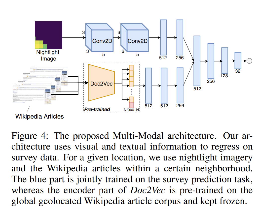
- The model is further extended to include information about nightime light intensity as measured by satellites
- This method is able to provide reliable predictions
Data used
- Asset ownership from DHS
- Corpus of geolocated wikipedia articles. For Africa there were roughly 50,000 such articles.
- Nightlights Imagery from VIIRS
Methods
- Wikipedia articles consist of a lot of bias in terms of information present, length of articles etc
- Doc2vec model is used to train the embeddings from the documents
Results
- Wikipedia embedding model outperformed the Nightlight-only model (train and tested within the same country)
- Wikipedia embedding contributes positively towards the predictions
- Multi-modal model performs best in all the different situations
- Results suggest that wikipedia embeddings and nightlight images provide highly complementary information about poverty