Efficient Poverty Mapping using Deep Reinforcement Learning
- Reinforcement learning approach in which free low-resolution imagery is used to dynamically identify where to acquire costly high-resolution images, prior to performing a deep learning task on high-resolution images
Dataset
- LSMS survey conducted in Uganda
- High resolution images from DigitalGlobe satellites with 3 bands (RGB) and 30cm pixel resolution
- Low resolution satellite imagery from Sentinel-2 with 3 bands (RGB) with 10m pixel resolution
Method
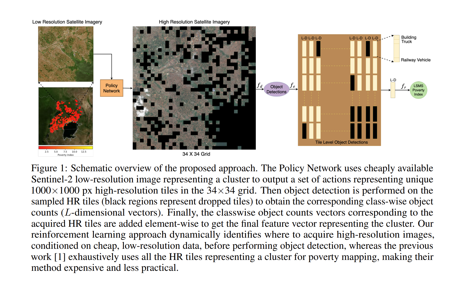
- In the first step, High Resolution (HR) tiles are adaptively sampled and in the second step, pre-trained detector is used on the images
Adaptive selection
- This framework finds tiles to sample, conditioned on the low spatial resolution image covering a cluster.
- A policy network is modelled to only choose tiles where there is desirable number of object counts
- The reward function encourages dropping as many subtiles as possible while successfully approximating the classwise object counts (object detection was used)
Results
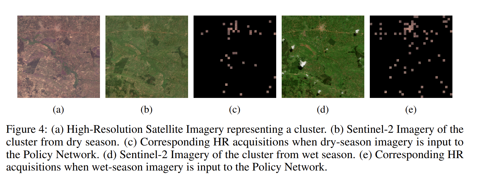
- The model achieved an R-squared of 0.62 and substantially outperforms results published from other studies, while using around 80% fewer satellite images.
- The model is performing well when images of wet season is used instead of dry season